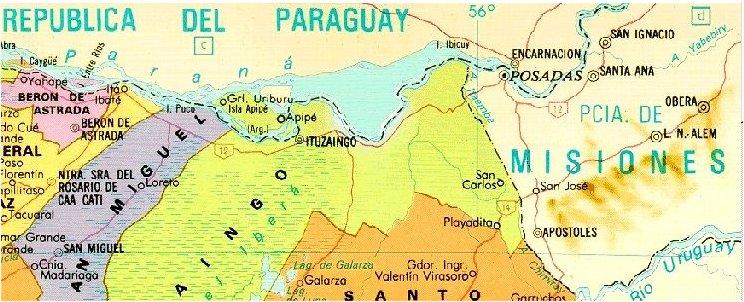
Apipé Islands
(in Guarani: lomadas) and almost 40 km further west, Entre Rios
Island are Argentine river islands situated between the Department of Missions
in Paraguay and
the Province of Corrientes in Argentina. They are surrounded by Paraguayan
territorial inland waters. Isla Apipé Grande appears to be the biggest true
enclave in the world with an area of about 276 km².
The islands that make up the
major group of Argentine exclaves are Apipé
Grande Island, Apipé Chico Is. and several minor islands and islet.
They are covering an area of more than 32,000 ha. All are surrounded by branches of the Parana River. The hydroelectric dam Yacyretá-Apipé, which began operations in 1994 and which provides electricity to the island, has made
the islands have been almost covered with water from the reservoir. Apipé Grande has a population of about 2,000
inhabitants. This island has a small town called San Antonio. There are practically no motor vehicles on the island.
While the sovereignty of the islands are
Argentinan, the surrounding waters belong to Paraguay, which transforms these lands into
exclaves. This situation has generated numerous conflicts, especially
when the islanders want to be transported to the mainland Argentina. 1)
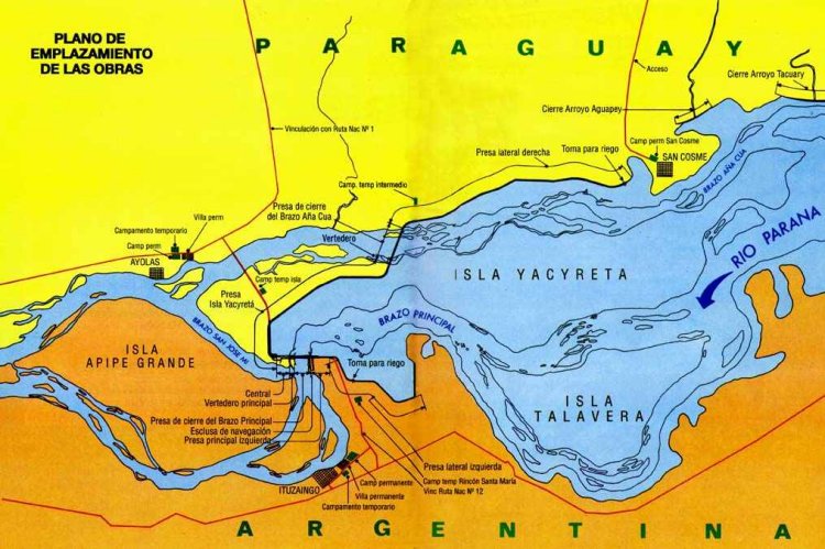
Isla Talavera was a Paraguayan island
east of Ituzaingo, now submerged by the reservoir of Yaciretá.
The
Argentina - Paraguay Boundary Treaty of February 3, 1876, establishes
the boundary as the midchannel of the main stream (de facto Thalweg) of
the Rio Parana to the Brazilian boundary or tripoint. There are two true
enclave areas; Isla Entre Rios and 39 km further east, Islas Apipé.
Considering that some of the smallest islets must be considered as
temporary islets, the Apipé Islands consist from four true enclaves;
Isla Apipé Grande, Isla Apipé Chico, Isla Ituzaingo and the island
southwest of Apipé Grande (unknown name).
From
this map we learn that the island east of I. Apipé Chico is called Isla
San Martin; and that the biggest Island southwest of I. Apipé Grande is
called Isla Los Patos.
Border
Treaty
Map
from Knaurs Grosser Weltatlas.
The
boundary follows the Rio Parana for approximately 732 kilometers (455
miles). It extends downstream between the Brazilian tripoint (ARBRPY) at
the confluence of the Rio Paraná and the Rio Iguazu (Rio Iguacu) and
the confluence of the Rio Paraná and the Rio Paraguay. The boundary
then follows the Rio Paraguay upstream for approximately 383 kilometers
(238 miles) to its confluence with the Rio Pilcomayo.
The
Argentina - Paraguay boundary treaty of February 3, 1876, delimits the
sector between the Brazilian tripoint and the confluence of the Rio
Paraguay and the Rio Pilcomayo as follows:
Article
1
Paraguay
should be divided from Argentina on the east and on the south by the
mid-channel of the main stream of the Parana from its confluence with
the Paraguay to the boundary of Brazil, on its left (east) bank, the
island of Apipe to belong to Argentina and the island of Yesireta to
Paraguay, as declared in the Treaty of 1856;
Article
2
Paraguay
should be divided from Argentina on the west by the mid-channel of the
main stream of the Paraguay from its confluence with the Parana, the
Chaco [belonging to Argentina] as far as the main channel of the
Pilcomayo …;
Article
3
The island of Atajo or Cerrito should belong to Argentina
and the remaining permanent or temporary islands in either the Parana or the
Paraguay to Argentina or Paraguay according to their [closer] position with
reference to one or the other republic …, the channels between the islands,
including Cerrito, to be common to the navigation of both states …
… 2)
Article in Corrientes Opina
Article 3 in the Treaty
refers to the two channels on this map (from point 1 to 2; and from
point 3 to 4).
By
Rodolfo Fernandez, National Deputy for the Province of Corrientes. Member of the Defense Committee. HCDN
It is like a story from a renowned global series, where a group of men and women are trapped on a Pacific island, and unable to leave her. But the fact is that Argentine residents living on the Island of Apipé in the province of Corrientes for many years have been helt hostages in a distressing situation. Apipé Island is in its entirety an Argentine territory, and our national flag flies every day at the local schools that educate Argentine children. But this exercise of sovereignty ends as soon as they touch the waters of the Paraná River, since the waters surrounding the island belong to
Paraguay.
An Argentine citizen who lives on the island, but works on any of the coastal villages of Ituzaingó or Ita Ibaté must perform daily immigration procedures, just listen to the stories from the villagers who live there in awe due to the
irrationality.
Decree no. 1585/82, signed by the then Argentine President Reynaldo Bignone
de facto approved the redefinition of the binational entity of Yacyretá. Several years ago, we began to negotiate with the Foreign Ministry a recovery from our lost sovereignty, but despite requests we failed to come to any
solution.
Teachers who must travel daily to the island teaching classes on Apipé undergo a daily discomfort; these education workers must apply for approval to Migration to leave Argentina and go to Argentina. In addition, daily incidents are recorded, even armed, among fishermen from Apipé and Paraguay, in which the rights of
apipeños [people from Apipé] are reduced because the Paraguayan Navy is having jurisdiction in those waters, despite the presence of a detachment of an Argentine Naval Prefecture on the island territory. The Paraguayan fishermen, act freely, of course, as any citizen who is in his own territory. If an
apipeño wish to catch fish he has to do it secretly and endure threats, many of them violent, and to be intimidated with guns. Paraguayan Navy patrols the insular area constantly, with the simple goal of preventing Argentines to live from
fisheries.
In March the presidents of Paraguay, Fernando Lugo, and of Argentina, Cristina Fernandez celebrated the reach of the final elevation of the Yacyretá dam. At no moment the need of restoring the lost sovereignty of the waters occupied the agenda of the current Foreign Ministry headed by Hector Timmerman. The Minister never addressed this issue, being a fan of social networks, or even dedicated a
"twit" to the tragic situation of these Argentines. The 2000 inhabitants of the Apipé Island, these Argentine citizens have the right, as any of us, to exercise fully the constitutional exercise of our country to could travel freely.
(Article
from the paper Corrientes
Opina on 10 June 2011, translated
from Spanish.)
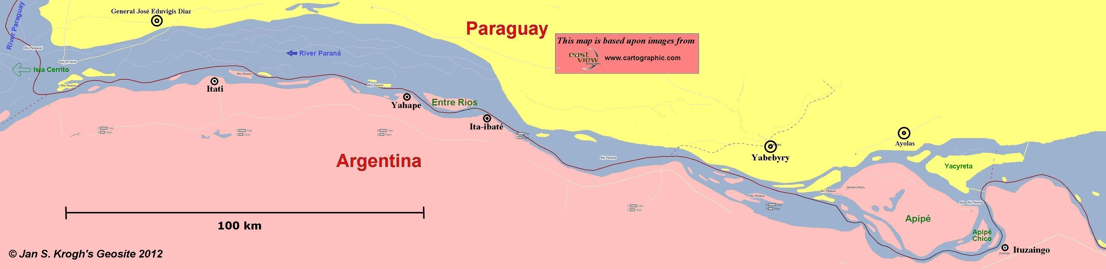
Teachers travelling daily
the 14,5 km long boat trip from the Argentine town of Ituzaingo to
the school at Puerto San Antonio on Apipé Grande, Argentina had in 2011
to pass Paraguayan passport and customs formalities since they travelled
through the territory of Paraguay.
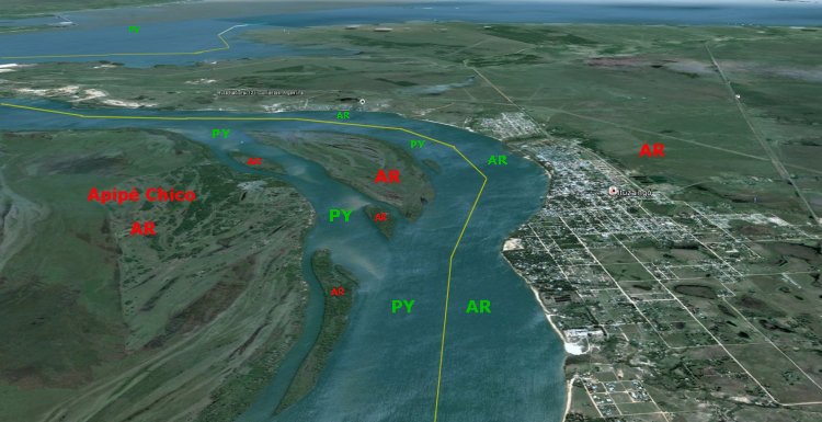
The
territorial situation west of Apipé Chico. In the background is the
town of Ituzaingo. (The drawn midchannel is an approximate
line.)
The
territorial situation at the town of Ituzaingo. (The drawn midchannel is an approximate
line.)
The
major part of Isla Yacyreta is under water as a result of the
construction of the dam.
Visit on 1 Sep 2011 to Isla Apipé by the Argentinian artist Dr.
Flooger. At 1:20 into the film the team departs from the Argentine
side of the Yacyreta Dam Gate and is transported over the Paraguayan
river territory to the village of San Antonio on Isla Apipé Grande by
an Argentine Coast Guard (Prefectura Naval Argentina) vessel
under the command of a Chief Petty Officer.
Calculated
area of Isla Apipé Grande is 276.0 km² which makes it the biggest true
enclave in the world.
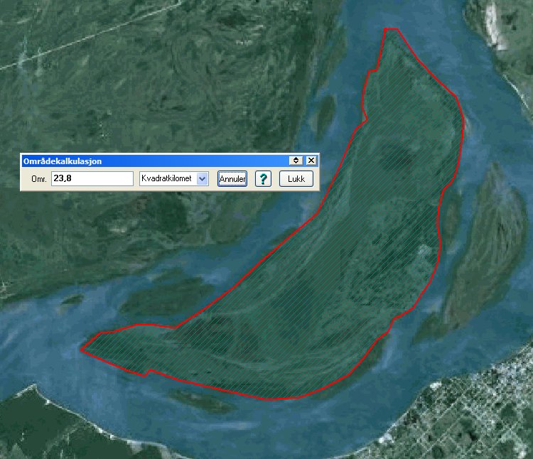
Calculated
area of Isla Apipé Chico is 23.8 km²
Calculated
area of Isla Los Patos is 11.8 km²
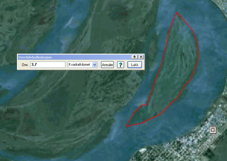
Calculated
area of Isla San Martin is 3,7 km².
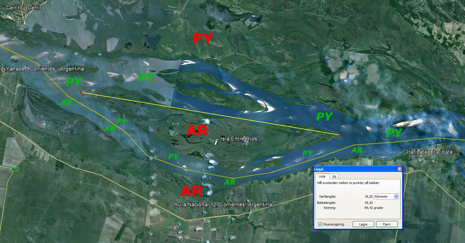
Isla
Entre Rios
Entre
Rios Island is about 19 km long and 3,6 km on its widest. It is
uninhabited, but is closer to Argentina than to Paraguay mainland at the
same time as it is situated north of the mid-channel of the main stream.
Since the Argentine island is surrounded by Paraguayan territorial
waters it is therefore an Argentine exclave and a Paraguayan enclave.