Jan
S. Krogh's Geosite: France
– Monaco (FRMC)
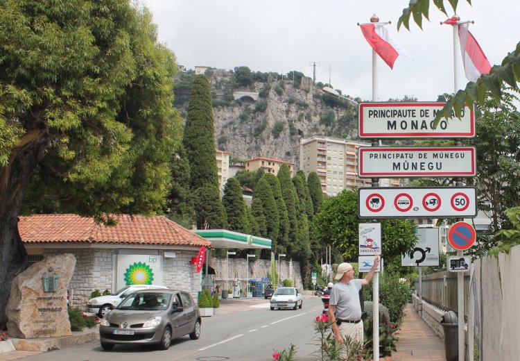
Monaco
shares a 4.4 km dry boundary with France. Also her territorial waters are
only shared with France. The state language is French, but due to
that the traditional national language is Monegasque, the entry signs to
the country, as well as many street signs, are bilanguaged. The
Monegasque boundary research is very difficult due to the lack of detailed
topographic maps. The only available recently published maps we have
available are tourist maps.
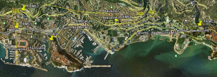
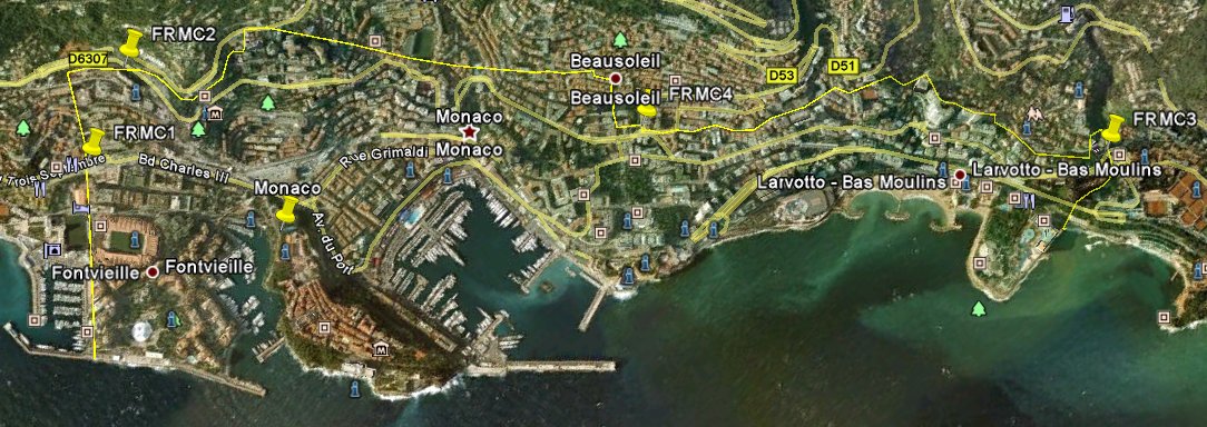
In
this report we will focus on three areas with modern markers on the
Franco- Monegasque border;
at Boulevard Charles-III (FRMC1),
Boulevard du Jardin-Exotique (FRMC2)
and Place Antonine-Repaire (FRMC3).
Furthermore we will study an ordinary border area (FRMC4).
These modern markers are no traditional border stones, but more one road
stone and some kind of touristic markers. The Jardin-Exotique
column is the closest we find to a traditional international border
marker. In general the Franco-Monegasque boundary's principal characteristic is
the almost total absence of any kind of demarcation. Even policemen
(French citizens in Monegasque uniforms) on duty at the border do not know
exactly where the border goes.
All photos were taken on 4
August 2011. (Click on the picture to get up a high-resolution image.)
Some important
dates
1346: The Lords of Menton sell their property to Charles Grimaldi.
1355: Charles Grimaldi acquires Lordship over Roquebrune-Cap-Martin.
These two communities became part of the Principality of Monaco.
Letter from Louis XIV to the Prince of Monaco in July 1705
1793: Menton and Roquebrune asked to be incorporated in France.
1814: Grimaldi takes over Roquebrune.
1815: Menton becomes a protectorate of Sardinia.
1848: Menton and Roquebrune align themselves with the Kingdom of Sardinia.
1848: In the plebiscite of June, Menton chose annexation to Sardinia.
1860: Menton and Roquebrune go to France.
1861: By the Treaty of Paris of February 2, Prince Charles III renounced his rights over Menton and Roquebrune.
The treaty of 2 February 2 1861 between France and the Prince of Monaco transfers Commons of Menton and
Roquebrune to France. Monaco's independence is recognized.
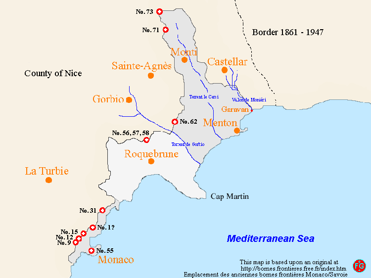
Monaco
- Savoy Border markers
There
are a number of old border markers between Monaco and Savoy. These boundary markers are located on the former border
between the Principality of Monaco and the County of Nice (Savoy). 1)