The Grand Duchy of Lithuania's
Vilnius Boundary Marker
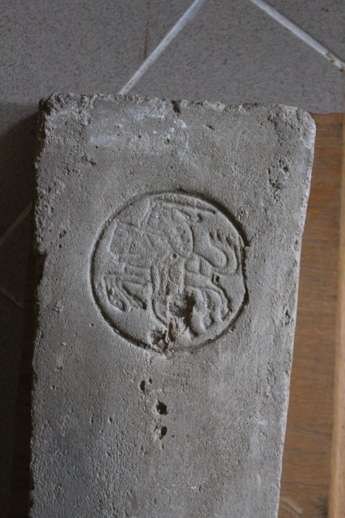
Historical XV
century border marker from the Vilnius Žvėrynas district which marked the western Vilnius boundary of the
Grand Duchy of Lithuania. The symbol is the coat
of arms of the Gediminaičiai dynasty.
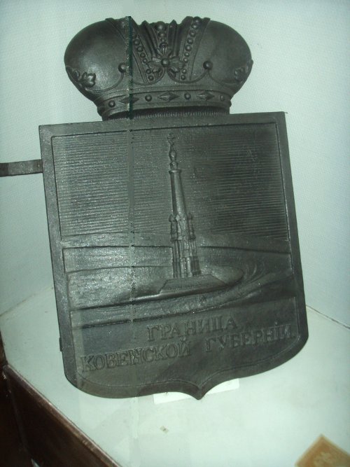
Border marker from the border between the governates of Kovno and Courland,
at the present border between Latvia and Lithuania.
(Photographed in Rokiškis Museum)
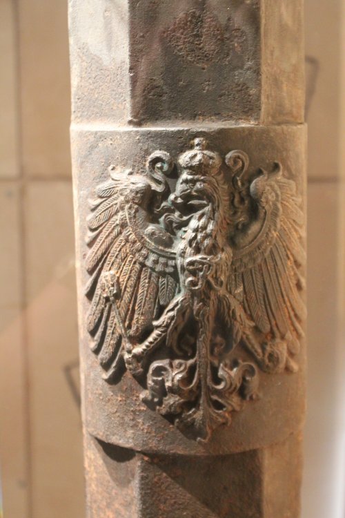
Germany -
Russia (1795-1918)
East
Prussian - Lithuanian border marker. Photographed from the
exhibition at the Lithuania Customs Museum.
The
Russian coat-of-arms.
The
German coat-of-arms.
In
the 2002 we
found a hexagonal boundary marker on the southern shore of the Vištytis
Lake, but of this only 1-2 cm was visible above the ground. This
is possibly the remains of an old Germany - Russian border marker, later
located at the same place as the Germany - Lithuanian border marker no.
150. Position: 54°23'14"N
22°45'58"E.
We
were told it was destroyed by the Russians in 1940, and that it had a
German Eagle on the top. At the Lithuanian border guard museum there might
be samples of the authentic boundary markers from the DELT border.Diameter
of the boundary marker on this photo is about 12 cm. It might be of
the similar type as the museum marker.
The
present LTRU boundary is practically the same boundary as the old
German-Russian boundary and before that the Prussian-Lithuanian boundary, one of the oldest in Europe.
Germany -
Russia (1795-1918), Germany - Latvia (1918-1920)
and Germany - Lithuania (1920-1939) at Palanga
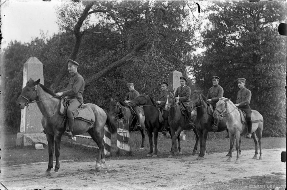
Boundary markers
at the German-Russian border between Nimmersatt and Palanga from the end
of the 19th century.
Latvian
Zemgale artillery unit before the retreat from the Palanga area. Source: Zudusī Latvija.
Latvian
Zemgale artillery unit before the retreat from the Palanga area. Source: Zudusī Latvija.
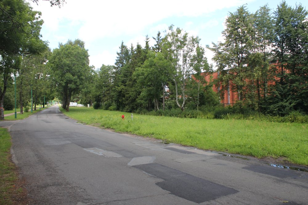
The
same point where these markers were located at photographed in July 2012.
Germany
- Lithuania (1920 - 1940)
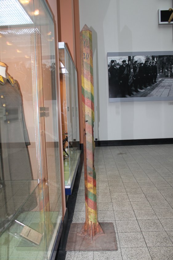
Lithuanian - German border marker from the 1930s and damaged from WWII. The
Lithuanian side of the marker has an "L" letter in the top and number 10.
(Photographed in Kaunas War Museum in 2012.)
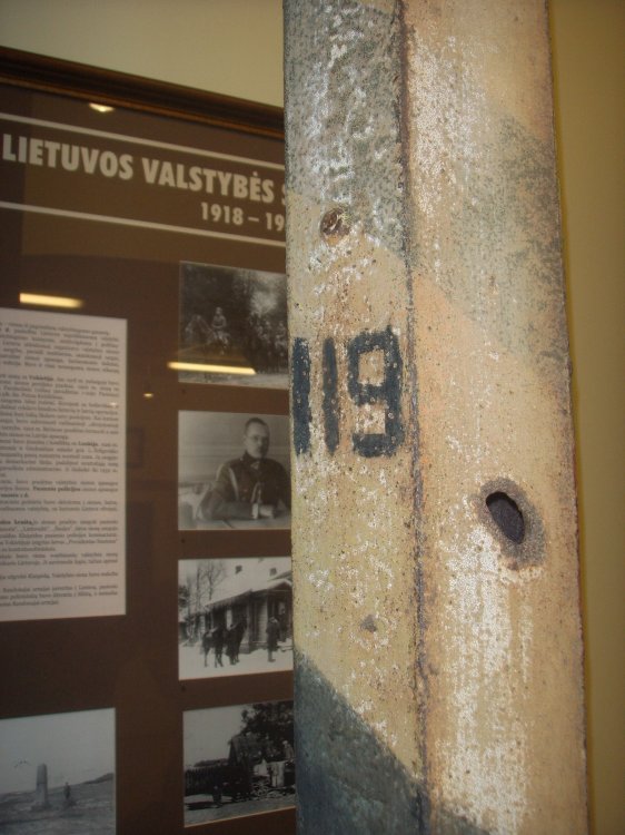
The other, German (D) side of the marker; notice number 119.
German
-Lithuanian boundary marker no. 119. Photographed in 2009 at the
Lithuanian Border Police Museum in Vilnius.
The
D symbolizes Germany (Deutschland).
Border
marker no. 119 was located between Kybartai and Vištytis.
Latvia
- Lithuania (1920-1940 and 1991-)
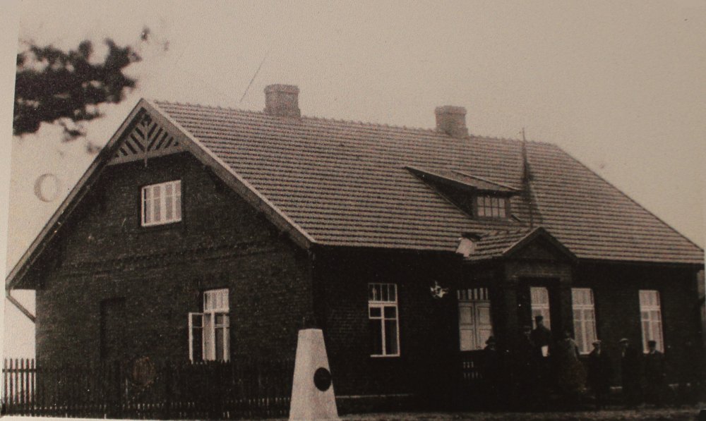
Žagarė Customs Office, constructed in 1928. Notice the possible border marker in front of the building.
The building was still standing in 2010 – see more photos from this
crossing here.
(Photo: Lithuanian Customs Museum.)
A very unique border marker told to have
been used at the boundary between Lithuania and Poland between Giedraičiai,
Lithuania and present Glitiškės, then Poland. It was until
about 1980 buried in a field near the boundary and donated to the local
museum. Photographed at Giedraičiai Museum.
On
the top of the stone there is the Lithuanian Coat-of-arms. There is
no record that there was any Polish border marker at this or any other
crossing at this border.
After
Lithuania's independence in 1990 the Soviet border markers at the Polish
border was painted in Lithuanian colours.
Lithuania
- Soviet Union (1939-40 and 1990-1991)
From
the demarcation of the Lithuanian - Soviet Union boundary in 1939 in front
of border marker I/167. The numbering system seems to be similar to the
present at the Polish border with Czechia and Germany. Later this
boundary was changed several times and makes now the boundary between
Byelorussia and Lithuania. Here is a group of Lithuanian military
officers; from left Ltn. B. Pupinis, Maj. S. Chamanskis, Maj. P. Krištapavičius,
Ltn. J. Vitkus, Ltn. Col. J. Andrius and Capt. A. Daujotas. (The
name of the soldier in front is unknown.) Source: Lietuvos
sienos, ISBN 978-9955-23-318-3.
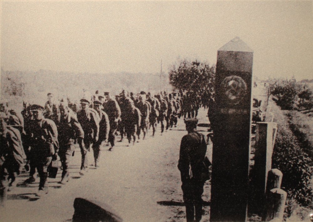
Units
of the Red Army cross into Lithuania on 15 June 1940. To left is a
Lithuanian border marker.
Also
from the Red Army crossing into Lithuania on 15 June 1940, but
photographed into the Soviet Union and with the Soviet border marker.
This
is a possible Soviet border marker from the 1940-1990 boundary at
Lithuania. Photo taken at the Lithuanian Customs Museum, Vilnius.
Byelorussia
- Lithuania (1991-)
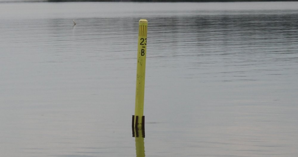
Lithuania
- Russia (2012)
Lithuanian-Russian
lake border buoy no. 23 - V. There are 23 such buoys numbered from the southern lake bank and towards the northern side. (B is cyrillic and means "V"
(Vištytis).
Read more about the lake demarcation here.