Indirect Latvian boundary
marker 0697.
Border pole distance from border line
is 2,6 m. Here the boundary does not change direction1.
Position:
56° 23' 35"N 23° 00' 30"E.
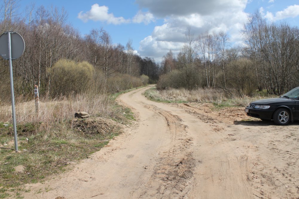
Towards south. Latvia to left
and Lithuania to right. The border runs in the middle of the ditch. In the
end of the 1920s the Mazrubėnas farm was located here on Lithuanian side of
the boundary. Now the area is an agricultural field.
Towards north. Also here it
was some buildings in the 1920s, maybe a border checkpoint.
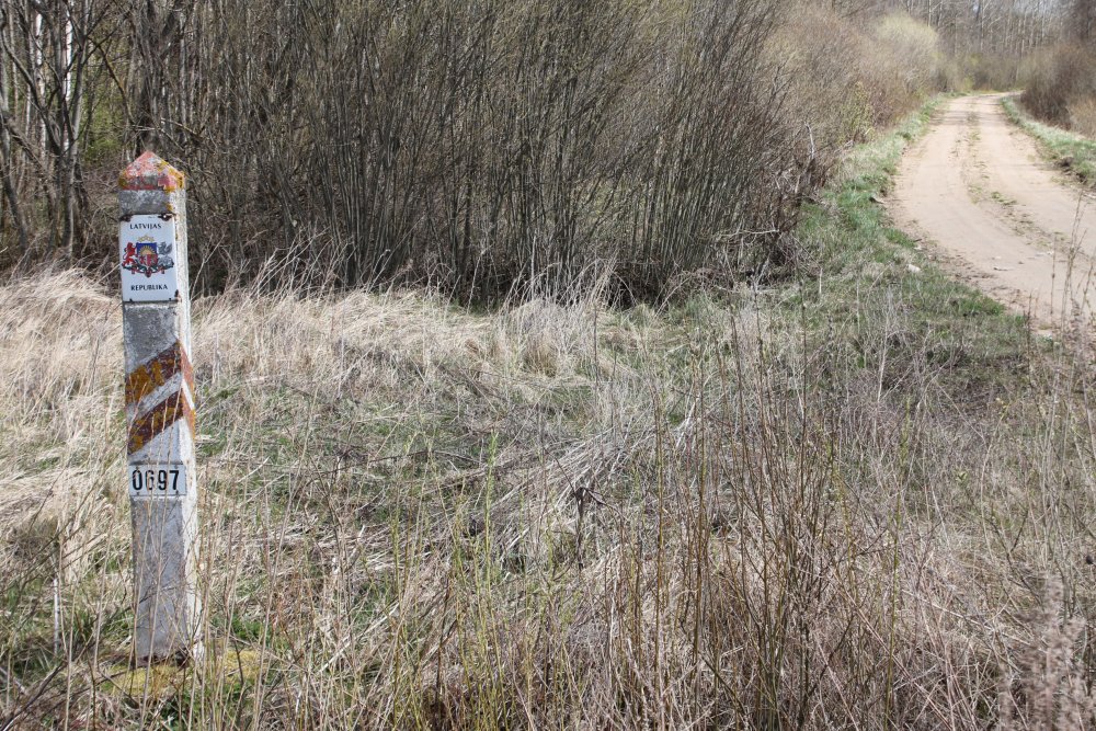
Towards the Latvian side and
marker 0697 to left.
Towards the north again.
Direct markers 0696 and 0695 in the vista.
Towards the Latvian side and
marker 0697 from concrete.
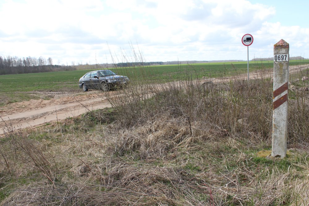
Towards the Lithuanian side
and Latvian marker 0697 to right. Only a Lithuanian traffic sign is placed
at the Lithuanian side of the line.
Maps
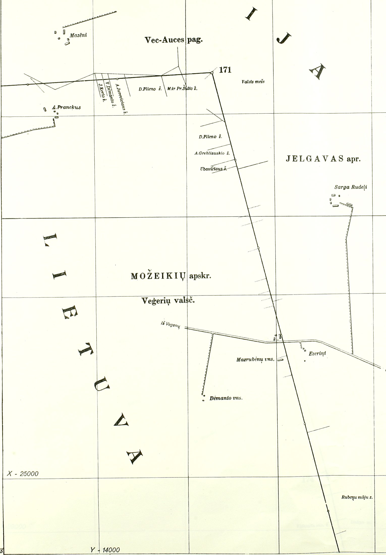
Border
map of 2012. Indirect Latvian marker 0697 and a poor unpaved road from
the Rubeni farm to the border.
According to the 1927 border
treaty map there was a 500 metre middle marker at this point, and a border
crossing existed 2.
Right north of the road there
were in 1927 some small buildings at the crossing point. South of the road
the farms Mazrubėnas was located on Lithuanian side, and Ezerini on Latvian
side 2.
The
point was visited in April 2015.
Sources
and links
Latvian - Lithuanian Border Treaty of 1927, page 404.
Latvian - Lithuanian Border Treaty of 1927, map no. 35.
This page was first time made on 13 June 2012. This page was
last time updated
26/04/15
.