Jan S. Krogh's
Geosite: Enclave/exclave of Brezovica – a Croatian True Exclave in
Slovenia
The
village of Brezovica is consisting from a small Croatian part, Brezovica Žumberačka,
and a major Slovenian part, Brezovica pri Metliki. The Croatian part of
the village is further divided into three fragments whereof one is the
exclave. But in everyday life the village of Brezovica is
functioning as one joined village. 4)
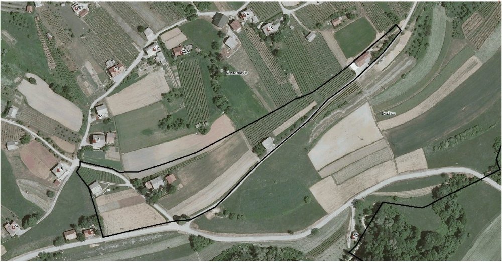
At
Brezovica Croatia has one true very small exclave completely surrounded by
Slovenian territory. The village is located about 4,4 km north of the
Slovenian town of Metlika. Both Croatian and Slovenian cadastre maps
confirm that there is one small enclave, although the boundary lines
slightly differ. The exclave is about 437 m long and about 60 m wide and
is populated by four dwellings surrounded by agricultural land. The
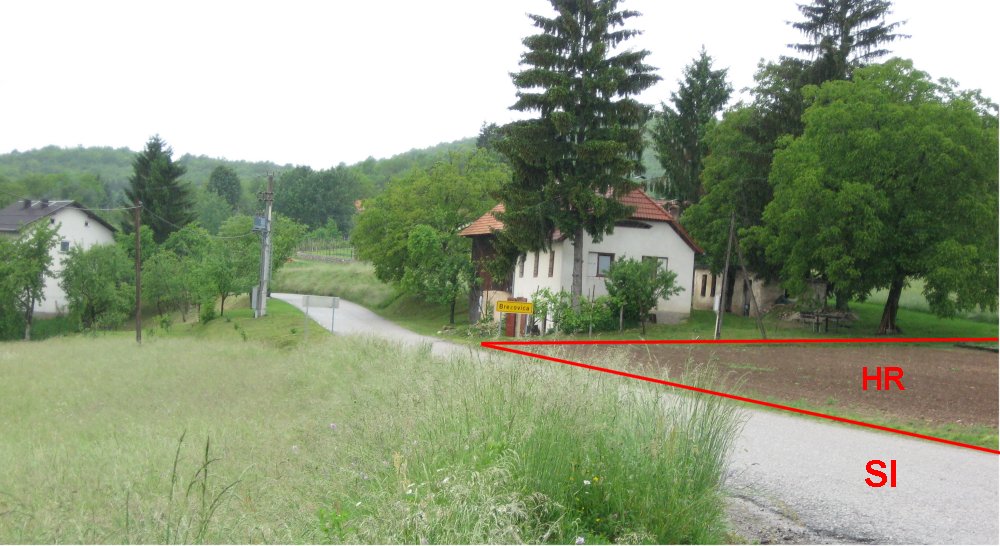
closest distance to Slovenian mainland is about 100 metres. The
yellow boundary line is Croatian while Slovenian boundary is black
lined.
Location: 45°41'22"N 15°18'12"E.
Croatian
exclave boundary. (Click on the image for a high-resolution picture.)
Slovenian
exclave boundary.
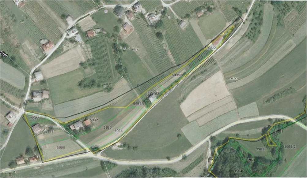
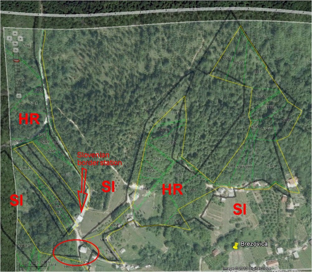
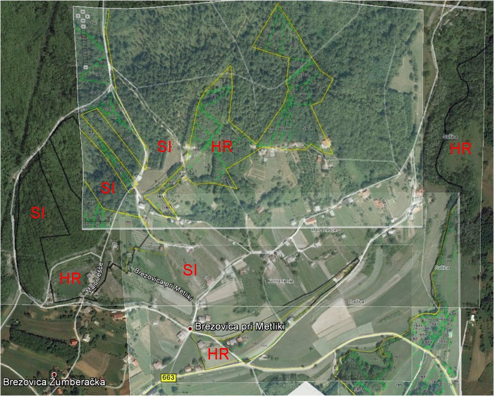
Orthophoto of the northern Brezovica border area. Black boundary lines are
according to the Slovenian cadastre map, while yellow lines are according
to the Croatian cadastre maps. Both countries border lines coincide in
general (maybe the Slovenian map is presented a bit inaccurate), but one
property (marked in red ellipse) does according to both the Croatian and
Slovenian maps neither belong to Croatia or to Slovenia 3).
According to the Croatian position the exclave northeast of this property
is a Croatian exclave, but since the property at this house according to
the Slovenian cadastre is not claimed by Slovenia the fragment is not
surrounded by foreign territory and can therefore not be a True Exclave.
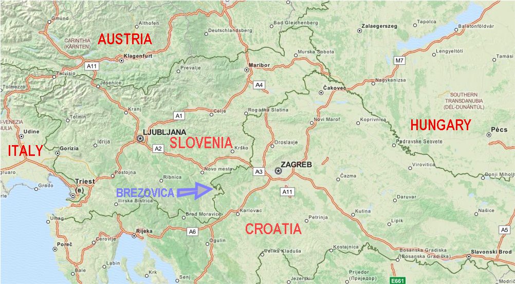
Brezovica
is located in the southeastern part of Slovenia, and about 50 km in air
distance from Zagreb. Image: Open Street Map.
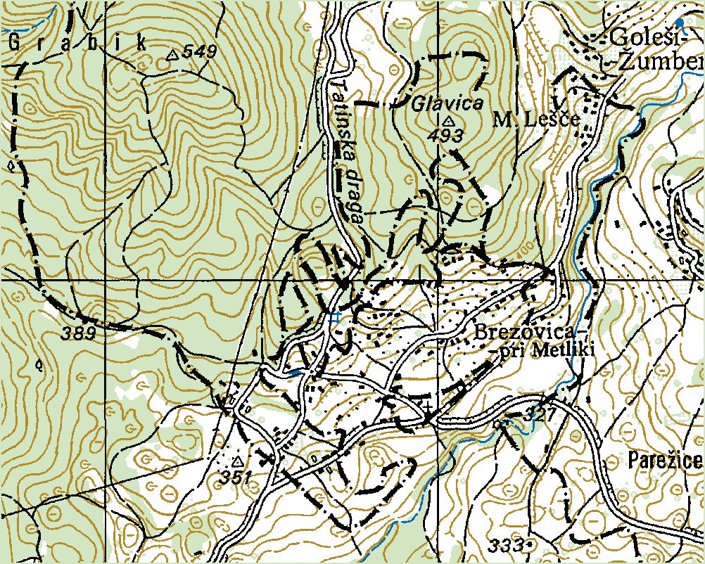
Yugoslavian
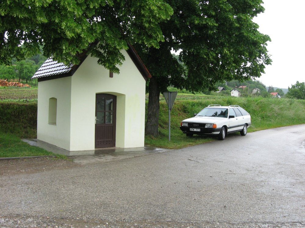
topo map. According to the map there is a chapel inside
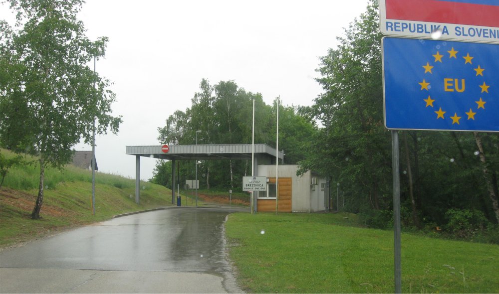
the exclave. 4) According to Irena Poženel, the head of
The Department for the State Border at the Surveying and Mapping Authority of the Republic of Slovenia, explained
on 15 April 2009 that the "border line" that connects the exclave with the rest of interstate
boundary is a line plotted for only for identification purposes in a computer program that calculates the area of
the closed polygon (in this case the entire republic).3,5,6
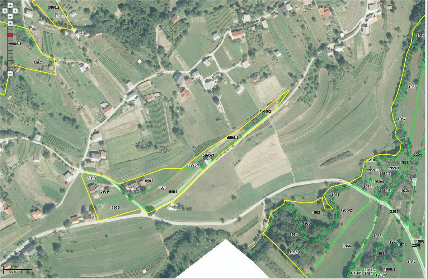
This
orthophoto shows the entire boundary area with both areas. Distance from
the northern area where Croatia claims a second exclave, to the small
exclave is in air distance about 300 metres (air distance).