The
residential area enclave north of the Dhekelia Power Station exclave is
the “EAC Refugee Settlement” - Προσφυγικός
Συνοικισμός
ΑΗΚ (pronounced Prosfygikos
Synikismos AIK) and the population was in 2012 around 700 people.
This is one of the many refugee settlements in Cyprus established after
July1974.
The
settlement was established in 1974 after the Turkish invasion in Cyprus
and eventual occupation of the northern part of the island. The invasion
created around 200.000 refugees and there was urgent need to settle them
in the areas controlled by the Republic of Cyprus. The area in which the
Settlement was established was property of the Electricity Authority of
Cyprus – EAC and at that time it was relented to the government of
Cyprus for the accommodation of refugees. Thus it developed to be a
residential area and this is why it is called EAC Refugee
Settlement.
The
two Dhekelia enclaves have always been considered by the local
authorities to be one enclave, although it was divided by the road from
the very beginning.
The
great majority of the residents come mainly from the nearby occupied
Famagusta area. The main criterion for the refugees choosing to be at
this refugee settlement had to do with being near their hometowns at
Famagusta rather than being employed at the Power Station or somewhere
near their residence, which at that time and even in 2012 was considered
temporary. To be more specific, less than ten people residing at this
settlement were in 2012 employed by and even less provide services to
the Power Station. 1)
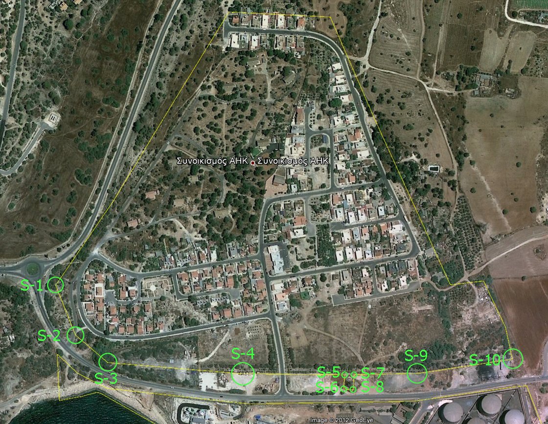
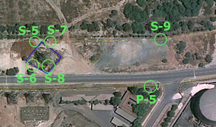
The
EAC Refugee Settlement enclave is completely surrounded by UK's ESBA
territory. The 28,0 ha territory is about 710 m west-east and about 590
m north-south. South of the this exclave is another Cypriot exclave, the
Dhekelia Power Station, only separated by a UK 45-50 metres wide road
corridor. The closest point between the two exclaves are 21 metres (near
the mast). On this image we have given the markers our own numbers; S-1
to S-10 in order to separate them since all border marker numbering was
unreadable.
The
Dhekelia Garrison is located west of the enclave.
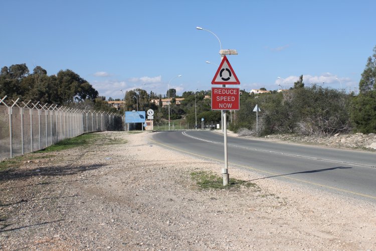
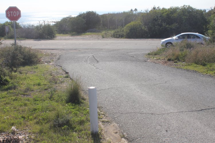
From
Power Station enclave border marker "P-1" in direction of the
roundabout.
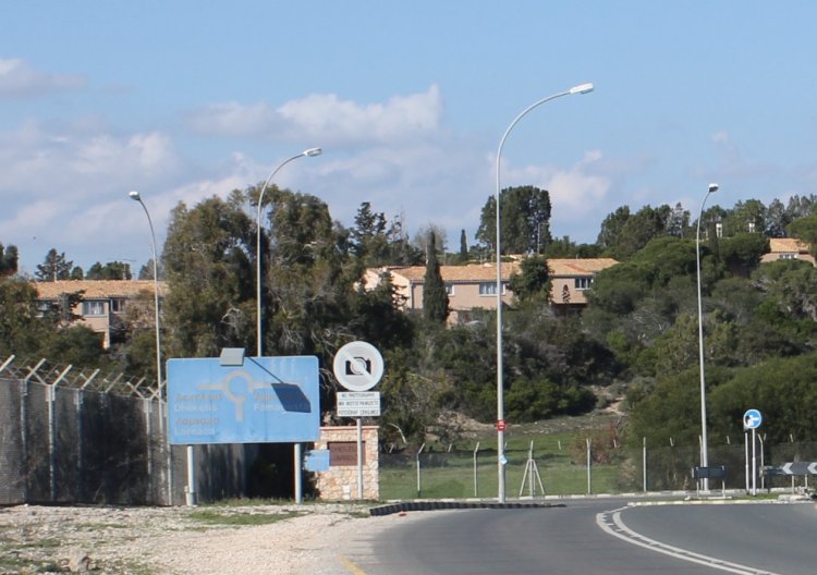
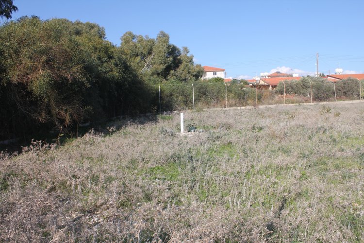
Border marker
"S-2" is located in the south western part of the Settlement
enclave of The Republic of Cyprus. Photographed towards north. The main
road and the area torwards the marker is territory of the Sovereign Base
Area of United Kingdom.
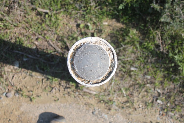
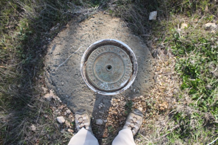
Close-up
photo of "S-2", photographed towards south.
On
the top it is inscribed the marker is placed according to a military
survey, probably by the UK.
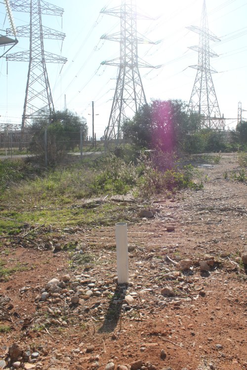
Further
east another border marker, "S-3" was found.
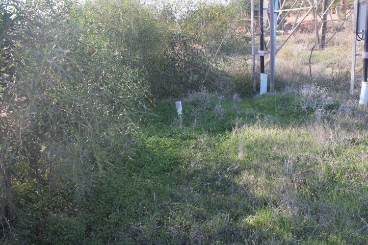
Location
of the border markers at the mast. The distance between marker
"S-8" and the Power Station enclave boundary is only 21
metres.
Border
marker "S-7" (closer) and "S-5" (behind the fence).
The boundary line is running further west just south of the palm line.
Compare this photo with Timothy's
image from 2004.
Marker
"S-7" is of Republican type.
Marker
"S-7".
Marker
"S-7" in direction towards the road.
Marker
"S-5" in direction towards the road.
Same
motif as above ("S-5") but slightly more in southwestern
direction.
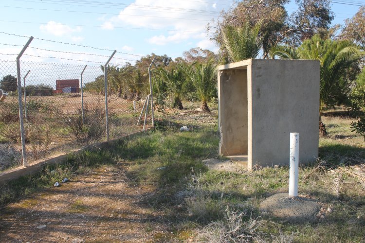
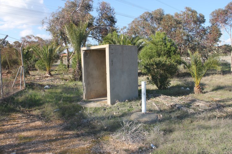
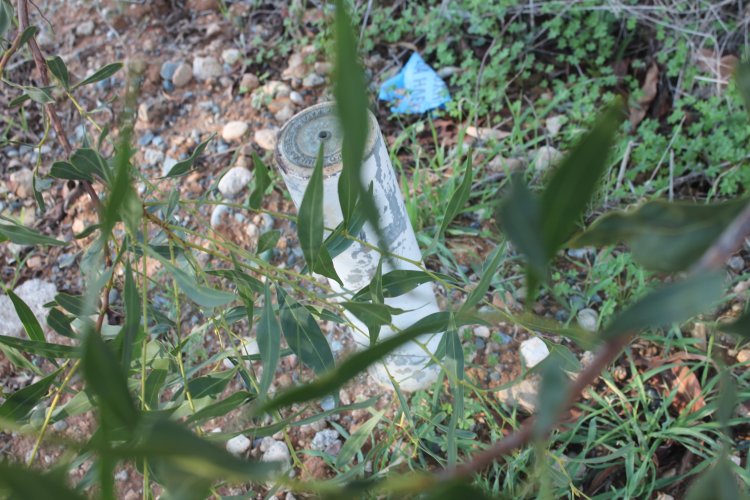
Marker
"S-6" is also of Republican type.
Marker
"S-6" is located just south of the fence.
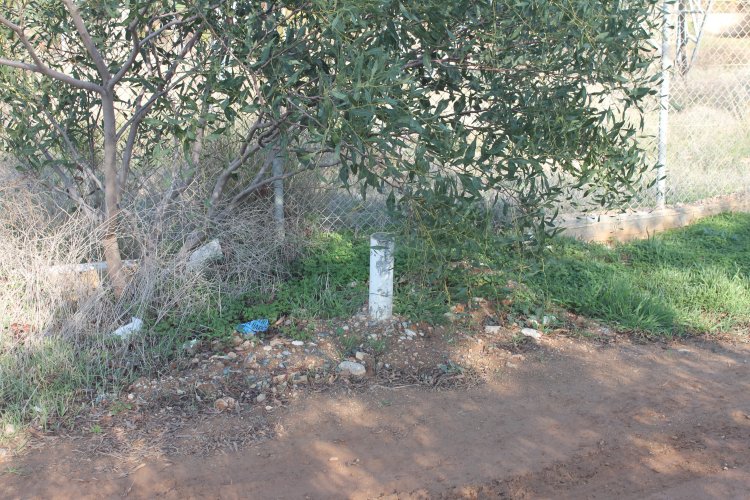
Marker
"S-8" is the only marker which is located inside the mast
fence.
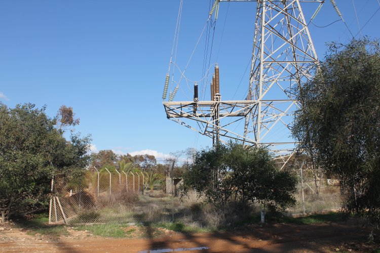
The
west - east line is deviating briefly by a square area where a power mast
is located. The fence around the mast is anyhow partly located outside
the Cypriot territory. Here we can see markers "S-5" and
"S-6".
Sources
1. Correspondance with Mr Andreas
Polydorides,
Station Manager at
Dhekelia Power Station (January 2012).
The page was first time published on 06/01/12. This page was
last time updated 16/02/12
.