 | |
|
Jan S. Krogh's Geosite: Byelorussia (BY)
– Poland (PL) – Ukraina (UA) Maps |
|
 |
|
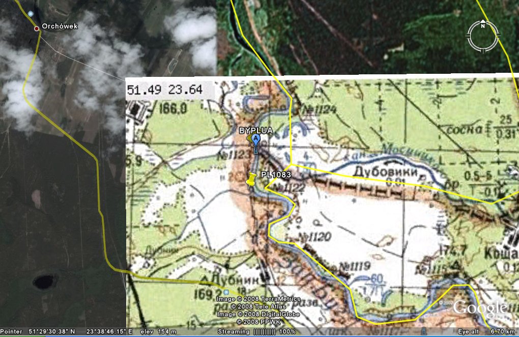
Polish map does not show any
referance to any BYUA canal near the tripoint.
(Geoportal.gov.pl, 2010).
|
|
|
|
Another, but older Polish map.
The BYPL boundary seems never to flow together with the Canal Moscickogo (Polish
name), but seems to follow just south of the canal. (General Staff
map, sheet M-34-024-A "Wlodawa", 1987.)
|
|
|
|
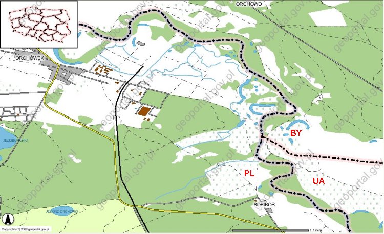
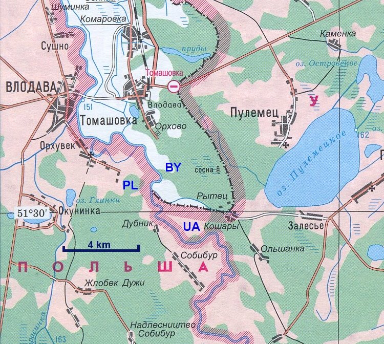
Byelorussian map. The BYUA
boundary seems not to flow together with the canal.
|
|

|
|
Ukrainian map. Here the BYUA is
clearly south of the canal. (Volins'ka oblast 1:200.000, VKF TS
ZS, 2007.)
|
|

|
|
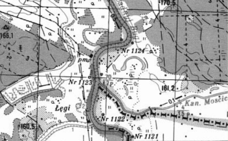
Soviet map, showing the position
of bordermarker 1123 next to the tripoint. PLUA numbers seems to follow an
other system as the PLSU (Polish - Soviet Union). The BYUA is south of the
canal.
Mr
Bogusław Tamoszewski explains why in an e-mail to me on 3 November 2012:
The
first BY bm Nr is 1123, but last UA bm Nr is 1083! Once, in the days of
the USSR, it had nr 1122, but after regaining its independence by the UA
numbering of the bms collated. The numbering of the PL-USSR bms was
ordered until 1951. From 1 to 2439. In 1951 between these countries were
the exchange of parts of the territories: http://en.wikipedia.org/wiki/1951_Polish–Soviet_territorial_exchange
. After the change the border ran: from tp marker „Krzemieniec”
(between the borders of Poland, the USSR and Czechoslovakia) to the
marker 224 (source of the River San), further by San to marker 350, from
marker 351-A to marker 432-A
(section land border set in 1951 as a result of the exchange of
territories), from marker 472
to marker 700, from marker 701-B to
marker 859-B (section of the border set in 1951 as a
result of the exchange of territories), from marker
860 to marker 1437 (boundary runs the River Bug), from
marker 1437 to marker 1987, i.e. to the present LTPLRU tp and from
1987 to marker 2439 where it ends (section of the border in the former
East Prussia). After bm Nr 432-A was bm Nr 472 and after bm Nr 859-B was
860.
As
you see: 472-432=40 (this gives the
39 sections between the bms.). It is interesting, that on the present
PL-UA border there are two nr 351 border markers!
Old 351 and new 351 (ex 351-A).
|
|
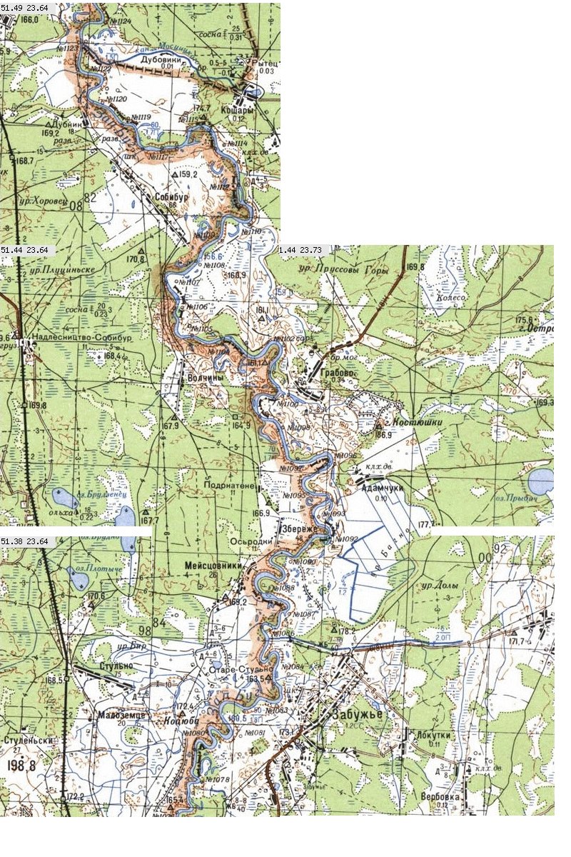
Soviet topomap over the area.
The PLUA marker numbers seems to have changed.
|
|
|
|
This page was last time updated 29.12.12
.
|