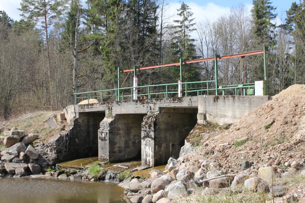
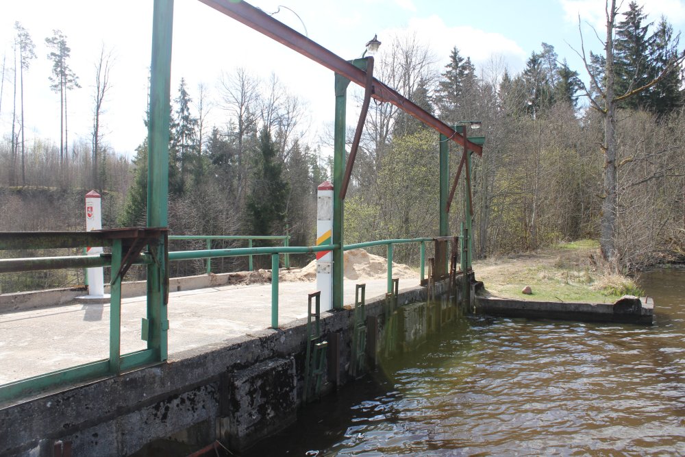
Boundary
marker 0443 (to right) and marker 0444 (to left). Photographed towards
south and Lithuania. The markers are located on the middle of a dam
which was constructed during the Soviet occupation. Therefore, compared
with the 1927 border agreement, the boundary line west of the markers
were adjusted in 1995.
Position:
56° 25' 52"N 22° 08' 00"E.
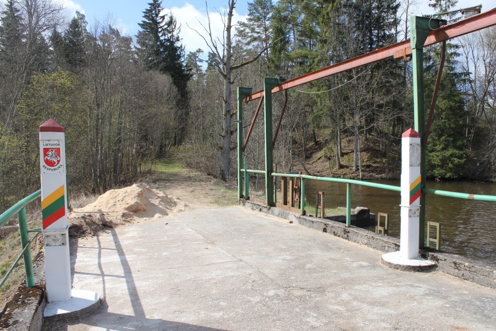
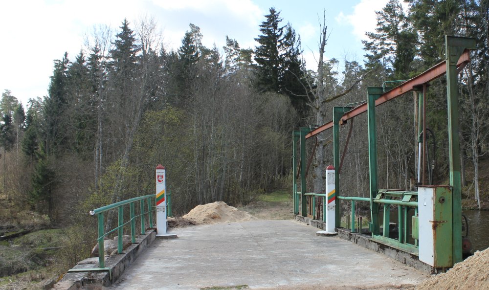
In the beginning of January
2008 the border closed at this point and locked by a gate, but was at our
visit again open. Before WW II it was a crossing point here. It is possible
for pedestrians to cross here, but on Lithuanian side the road was a bit
overgrown by vegetation.
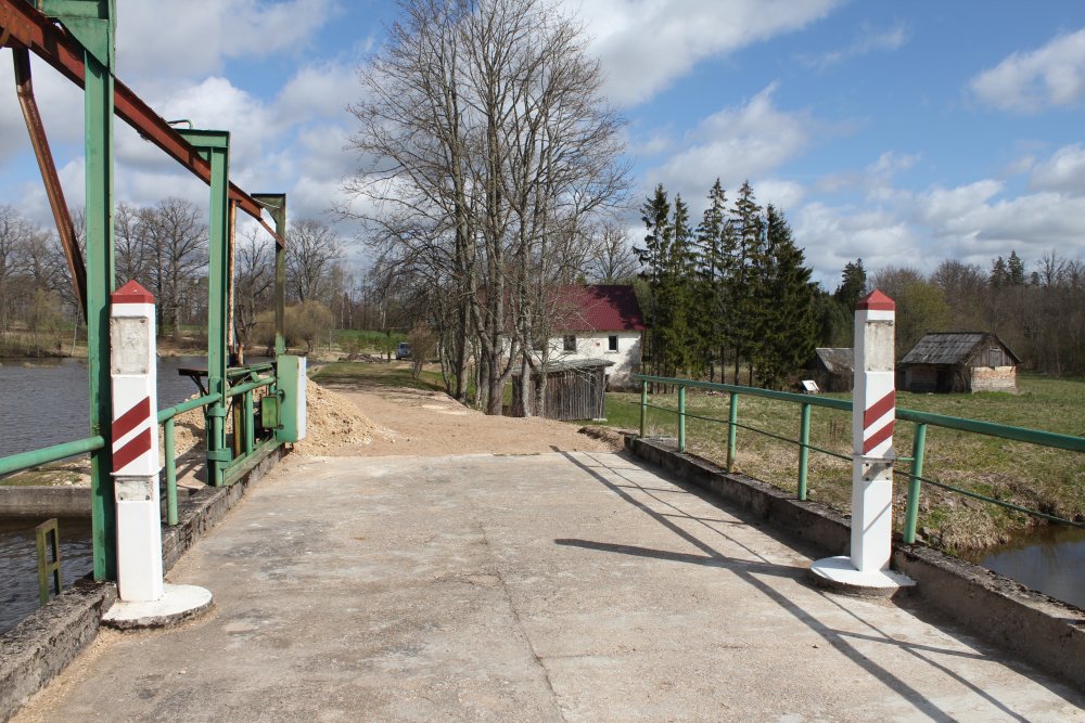
Photographed towards north and
Latvia. Most of the coats-of-arms and all border pole numbers were removed,
probably by vandals.
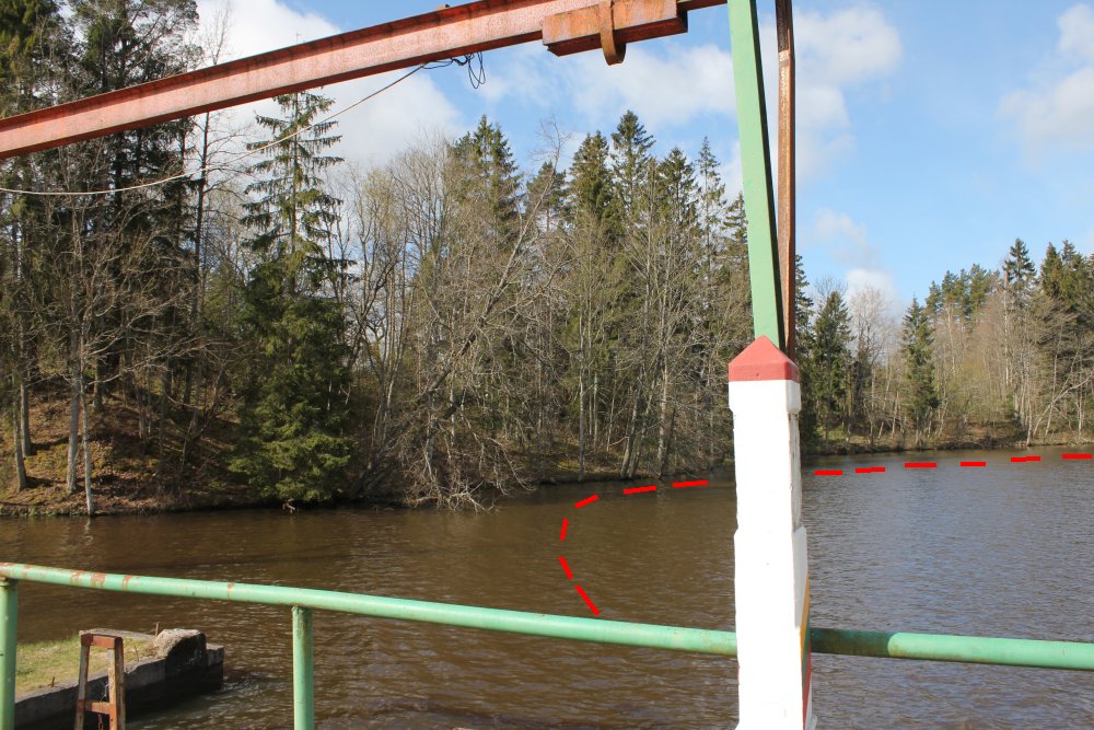
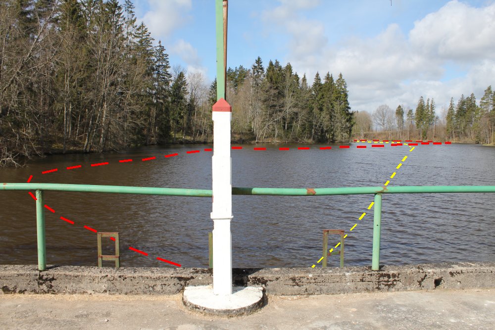
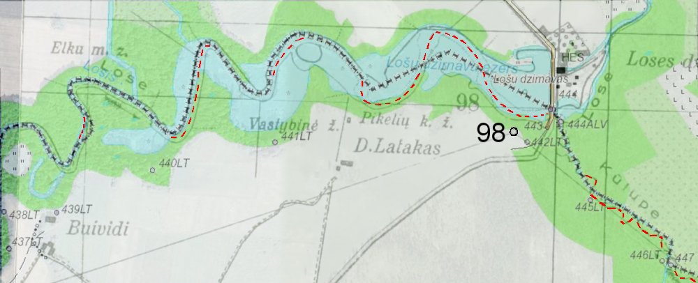
The old border line (approximately plotted
in red) followed the midline of the river.
The new border (in yellow) runs
approximately in the middle of the dam. The boundary is mostly adjusted in
the eastern part of the dam. Further west we found only smaller corrections.
The two border markers photographed towards
southeast.
Overview photo. River Kūlupė
can only barely be seen in the left part of the
photo.
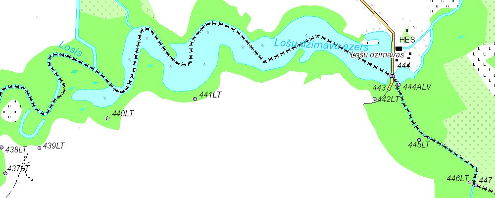
Maps
Border
map of 2015. The border runs basically along the 1927 border but was
adjusted since it after WW II was constructed a dam here. The old border
line is now partly on the southern bank of the dam. River Kūlupe was
also regulated, and the border is adjusted so it follows the midline of the
river. (Source: LGIA)
Compared with the pre-war
border (in red), the present border (in black) differs up
to 40 metres (west of the dam). The pre-war
border marker no. 98 was not located at any of the new border marker
locations. In the dam Lithuania seems to have gained about 6,3 hectares
while Latvia appears to have taken over 4,53 hectares. Also at Kulupe it
might look that Lithuania has achieved some smaller area. In this area
Lithuania might net have taken over about 2 hectares from Latvia.
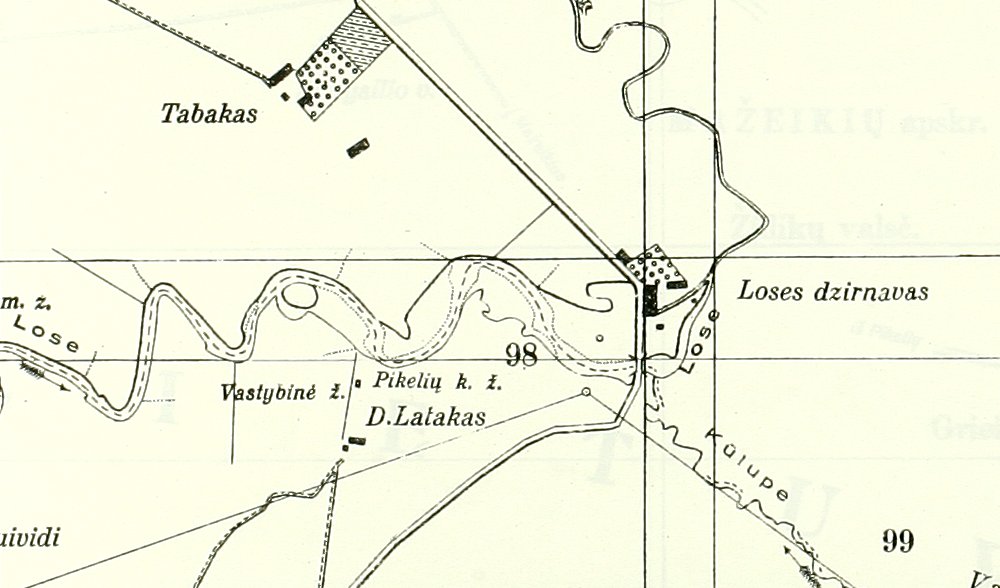
1927 border map fragment. The border run in the middle of the Rivers of
Kulupe and Loše.1
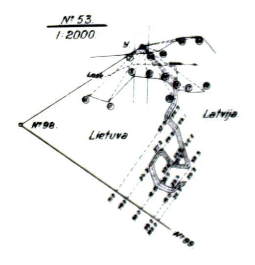
Another detailed drawing from the 1927 Border Treaty regarding the turning
point between River Loše and River Kulupe.