Jan
S. Krogh's Geosite: Bosnian exclave of Međurječje
(Under update)
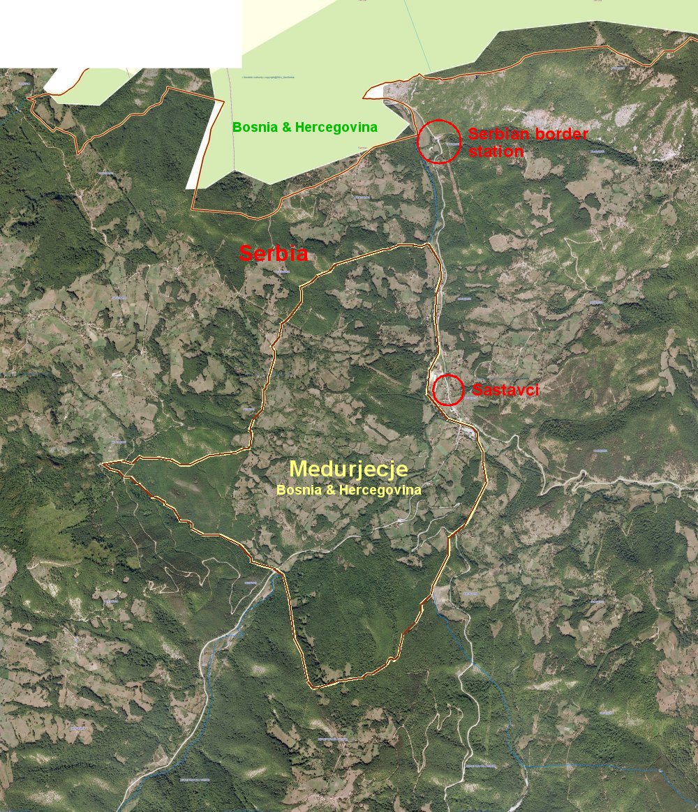
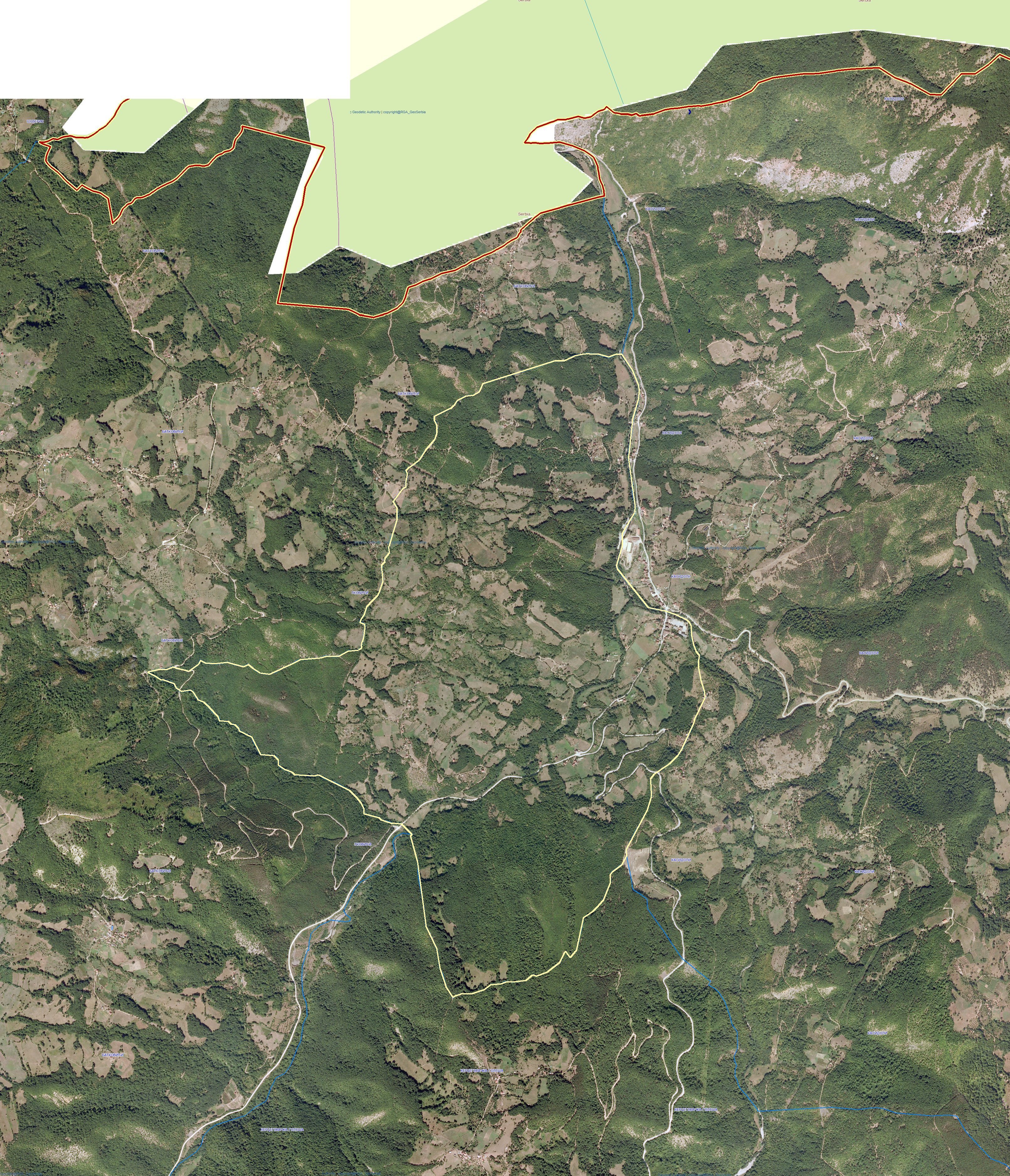
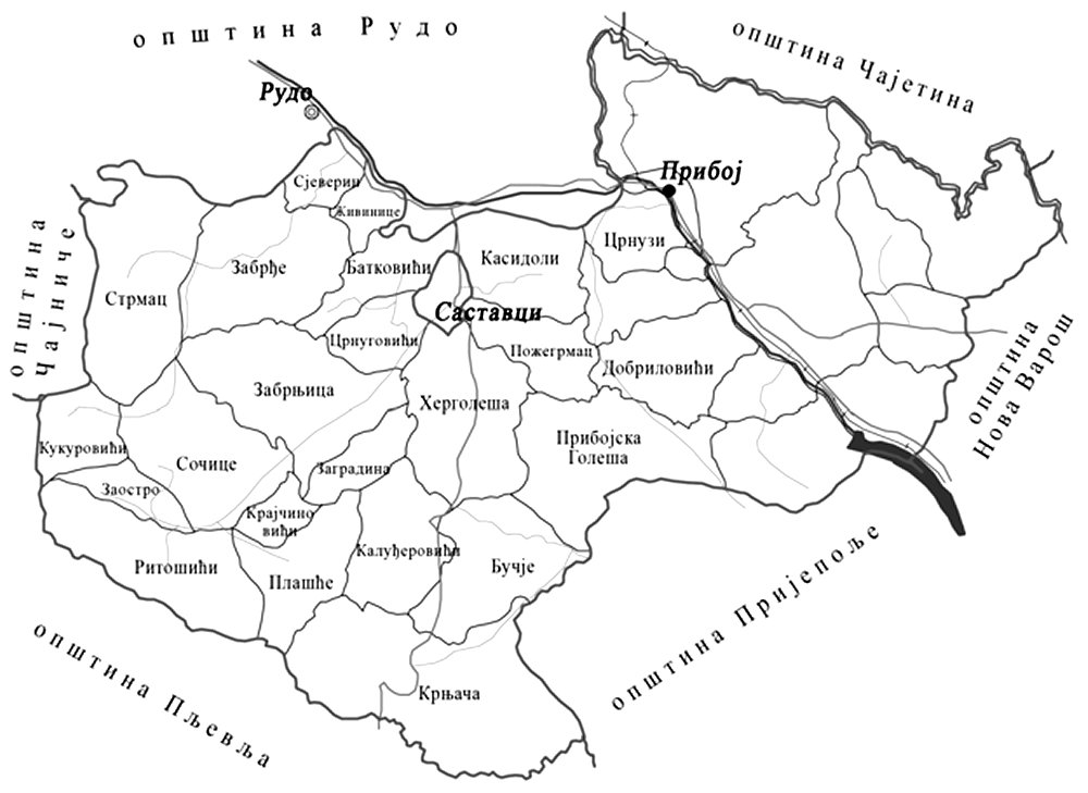
Međurječje is
an exclave of Bosnia and
Herzegovina and located as an enclave just west of the Serbian town of
Priboj in the region of Zlatibor. All infrastructure and systems
(electricity, telecom, education, medical care etc.) in the enclave are
tied to the Serbian municipality, but the citizens were paying land tax
to the Bosnian municipality of Rudo. This also includes Serbian citizens
when it comes to business buildings. The distance of the exclave to the
mainland is about 1130 metres.
The enclave of
Međurječje is a part of the Medjurecja village of the municipality of Rudo, Bosnia and Herzegovina,
with the area of 395 ha, 83 acres and 57 m² – about twice the size of
Monaco. (The area represents 1990 metres2) . It is
situated about 400-500 metres above sea level.
The population was 270 persons (1999) and
including 75 households. More than 70% of the citizens living in the
exclave are Serbian citizens. 135 persons with 25 households were
Bosnian Muslims. 1)
The
Bosnian - Montenegrian - Serbian (BAMERS) tripoint is located 15 km west
of the enclave.